

Cold front brings storms overnight, lower humidity Thursday
It has been another stormy day across Middle Georgia and we will likely see a few more storms through Thursday morning.
A cold front is pushing through North Georgia this evening and with it, a few storms will be possible tonight and into tomorrow morning. The front will finally pass tomorrow afternoon, but will stall out close to the coast.
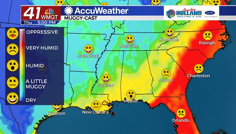
We will continue to see warm conditions on Thursday with highs still warming to the 90’s, especially with the introduction of some dry air. Although the dry air will allow us to warm up, it will feel WAY more comfortable than the oppressive humidity of the past week.
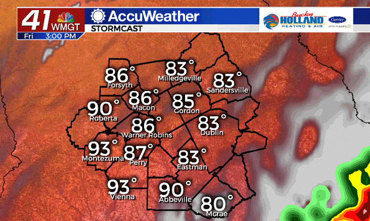
Friday will bring a mostly dry day across Middle Georgia, the exception being in our southern counties.
The cold front that is moving through tonight, will get stalled along the coast and transition to a stationary boundary. This means isolated showers will be possible mainly south of Dublin through Saturday.
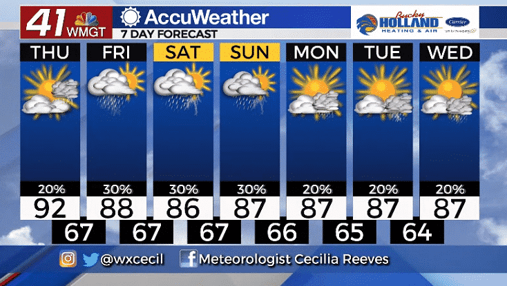
Through the weekend we will see a chance of storms continuing with highs in the upper and mid 80’s.
There are still quite a few questions that we have about our forecast heading into next week, but right now we are keeping summer-like rain chances for Monday through Wednesday.


Leave a Reply