


Staying warm this weekend
It has been a pretty stormy day for much of Middle Georgia, but we will be getting a break from the storms for at least a day.
Although a few showers will be hanging around during the early morning hours Saturday, sunshine returns for the afternoon.
A warm front that is pushing up from the south will help us warm into the mid 80’s for the afternoon hours.
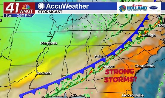
By Sunday another cold front will be approaching the area, bringing a chance for storms and a little bit of a cool down for the start of next week.
The latest model data suggest the line will be moving through Middle Georgia during the afternoon on Sunday, but it is still too far out to know for sure.
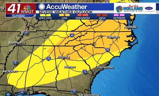
Although the main dynamics that would give us a larger severe threat are staying well to our north, a severe threat will still be out there for our area.
Main threats for Sunday look to be damaging wind gusts, severe hail, and maybe an isolated tornado.
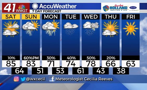
Next week our weather will be staying relatively unsettled with rain and storms sticking around.
Highs on Monday will be much cooler than the weekend, but we will be warming through the middle of the week.
A big cool down is on the way for the end of next week behind a cold front, that will drop our temperatures into the 60’s with the potential for lows in the 30’s (!!).
Leave a Reply