
Severe storms possible Sunday
A line of strong storms is currently working its way across the southeast, bringing tornado warnings, damaging wind gusts, and heavy rain to parts of Arkansas, Tennessee, and Louisiana.
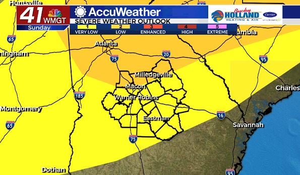
This line of storms is along a cold front that will bring the threat for severe storms to Middle Georgia by tomorrow afternoon.
The Storm Prediction Center currently has the far northern portion of Middle Georgia under a level 2 threat for tomorrow with the rest of the area in a level 1 threat.
Main storm threats for Middle Georgia will be damaging wind gusts, isolated, brief spin-up tornadoes, and heavy rain that could lead to localized flooding.
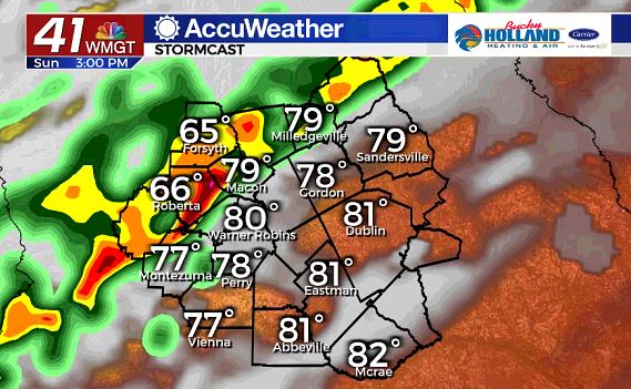
As far as timing is concerned, the line will be in Middle Georgia after around 2pm, and will have the highest severe threat when it is north of Macon.
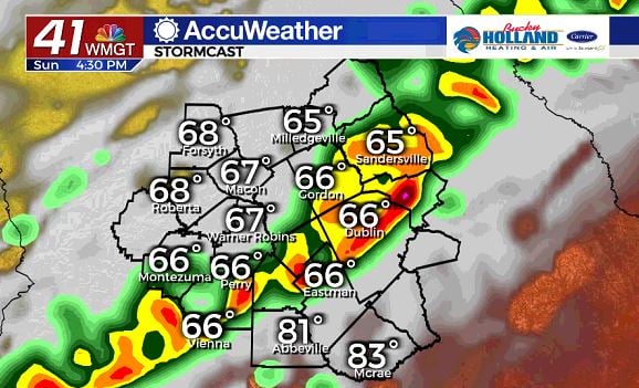
As the line moves further southeast we will likely still see strong storms, but the threat for tornadoes will be much lower as the front gets closer to the coast.
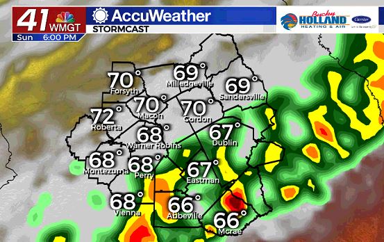
By Sunday evening the front will be moving out of the area and the rain will be ending.
Although this model data shows the rain exiting the area by around 6:30, it could be as late as 9 pm.
Even though the severe threat is on the low end, you still need to stay weather aware and have a way to get your severe weather warnings.


Leave a Reply