


Severe storms possible Wednesday
A warm front has started its push north into Middle Georgia this evening bringing a few showers to the area and some warm overnight conditions.
Clouds will be sticking around overnight and keeping our lows in the 60’s with highs tomorrow warming into the 80’s.
This warm up will help us get some thunderstorm fuel going for tomorrow afternoon, before our next chance of severe storms.
The Storm Prediction Center currently has Middle Georgia under level 2 threat for severe storms, mainly tomorrow afternoon and evening.
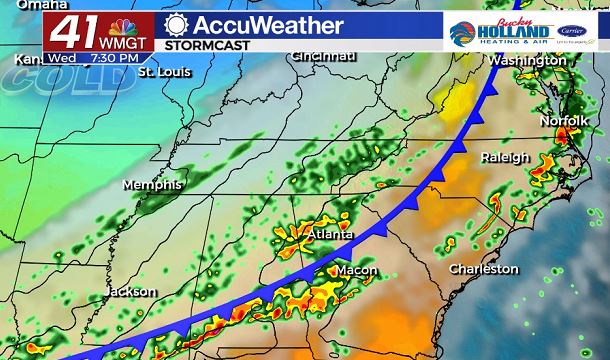
A cold front will be approaching the area starting tomorrow afternoon.
A few storms along and ahead of the front will become strong to severe.
Timing for these storms will be 4pm- 10pm across Middle Georgia, so be ready for a potentially challenging evening commute.
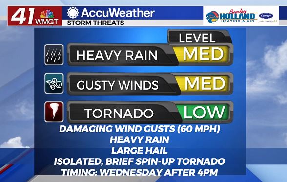
As far as threats are concerned with these storms, damaging winds(gusts over 60 mph)will be the greatest threat.
We are also expecting heavy rain, frequent lightning, and the possibility of large hail.
An isolated, spin-up tornado can’t be ruled out with a few of the storms tomorrow, but those are going to be a lesser threat.
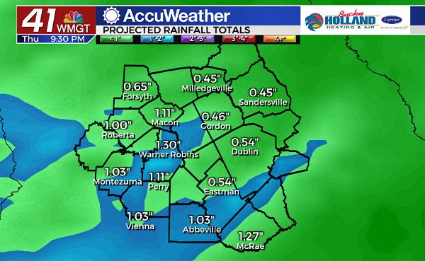
As far as heavy rain being a factor, we could see some localized flooding in areas that see over 1″ of rain in a short period of time.
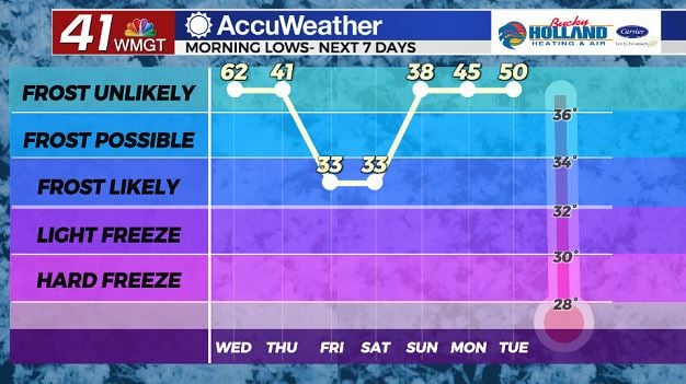
Behind the front, we will be getting a big cool down and some windy conditions.
Lows into Friday and Saturday morning will be dropping into the low 30’s.
Highs during those days will be limited to the 50’s and 60’s as well, but at least we will be seeing clear skies.
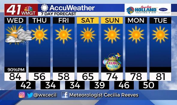
Sunshine will be sticking around through the weekend for what looks to be a quiet Easter weekend.
Highs next week will be warming into the upper 70’s and low 80’s with high pressure in place, at least for the start of the week.
Leave a Reply